Data Collection First, Decisions Later: A Smarter Way to Design Broadband
Full asset visibility with only 3 days of field work across nearly 400 miles of fiber network route, delivering permitting maps and design-ready data faster than ever.
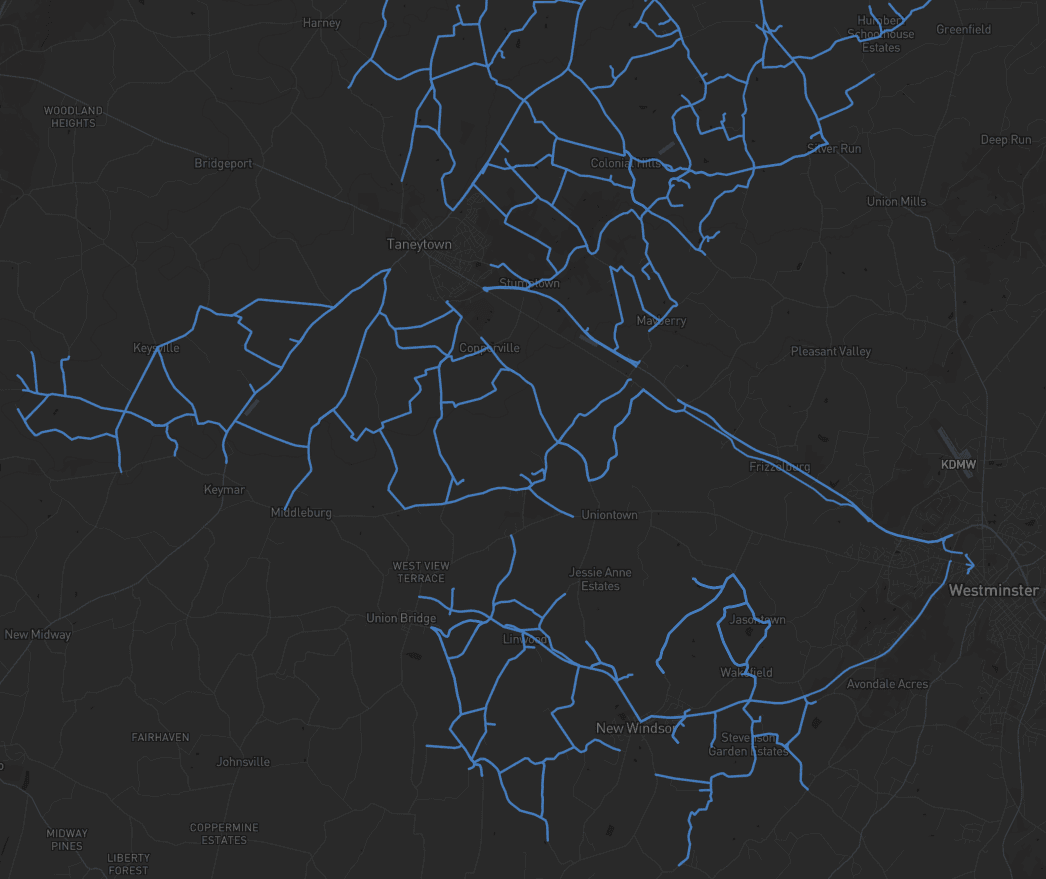
Modernizing the workflow at scale.
Bringing broadband to rural communities isn’t just about ambition, it’s about execution. The key to Fibersmith’s success? Figuring out how to design and permit high-speed networks across vast rural terrain without burning months in the field. Their solution: A new, smarter workflow powered by the efficiency of mobile LiDAR collection and automated asset extraction in Mach9 Digital Surveyor.
What made this hard.
In Carroll County, Maryland, Fibersmith was tasked with designing fiber infrastructure across dozens of miles of rural roads. Traditionally, survey crews would walk or drive the routes with 11x17 paper maps or ESRI FieldMaps on a tablet, manually logging conditions like gas mains, surface types, and utility poles. The pace? Around 2-3 miles per day with incomplete coverage and a constant risk of rework.
Fibersmith knew there was a better way to collect data than telling crews what to collect and hope they got it right. Mobile mapping provided a method for capturing detailed LiDAR data in a single pass. But capturing data is just the first part, processing and extracting the right asset information from LiDAR quickly is the second problem to solve. This is where Digital Surveyor steps in, bringing a fast solution with automated asset extraction.
How we solved it.
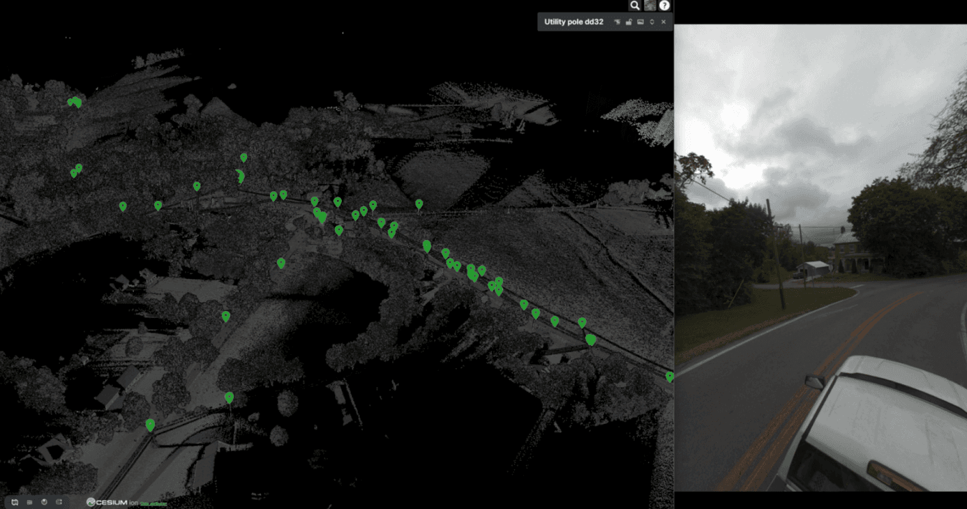
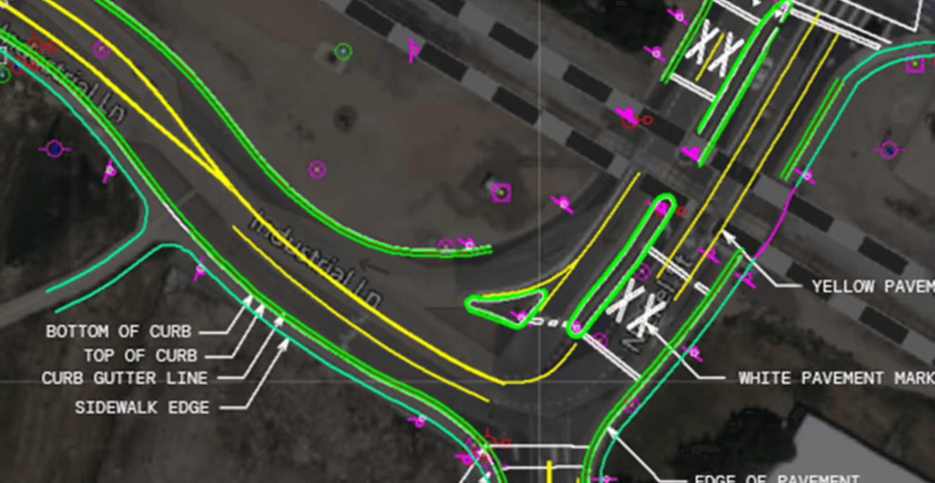
Fibersmith collected mobile LiDAR across the entire project corridor in just three days. The data-rich, 360-degree point clouds were uploaded to Digital Surveyor for automated feature extraction. Since Digital Surveyor uses machine learning for extracting all necessary assets Fibersmith might need (such as poles, signs, and meters), it gave the team the flexibility to see everything first, and then make an informed decision to go underground or aerial.
- 01Visualize every asset in high detail
- 02Filter for relevant features (poles, signs, meters, etc.)
- 03Make broadband design decisions after data collection, not before

We did three days of collection, that would have taken us more than two months, and we captured everything, not just what we thought we needed. Now, we collect everything first, then ask: Underground or aerial? We decide that later, in the office, with confidence.

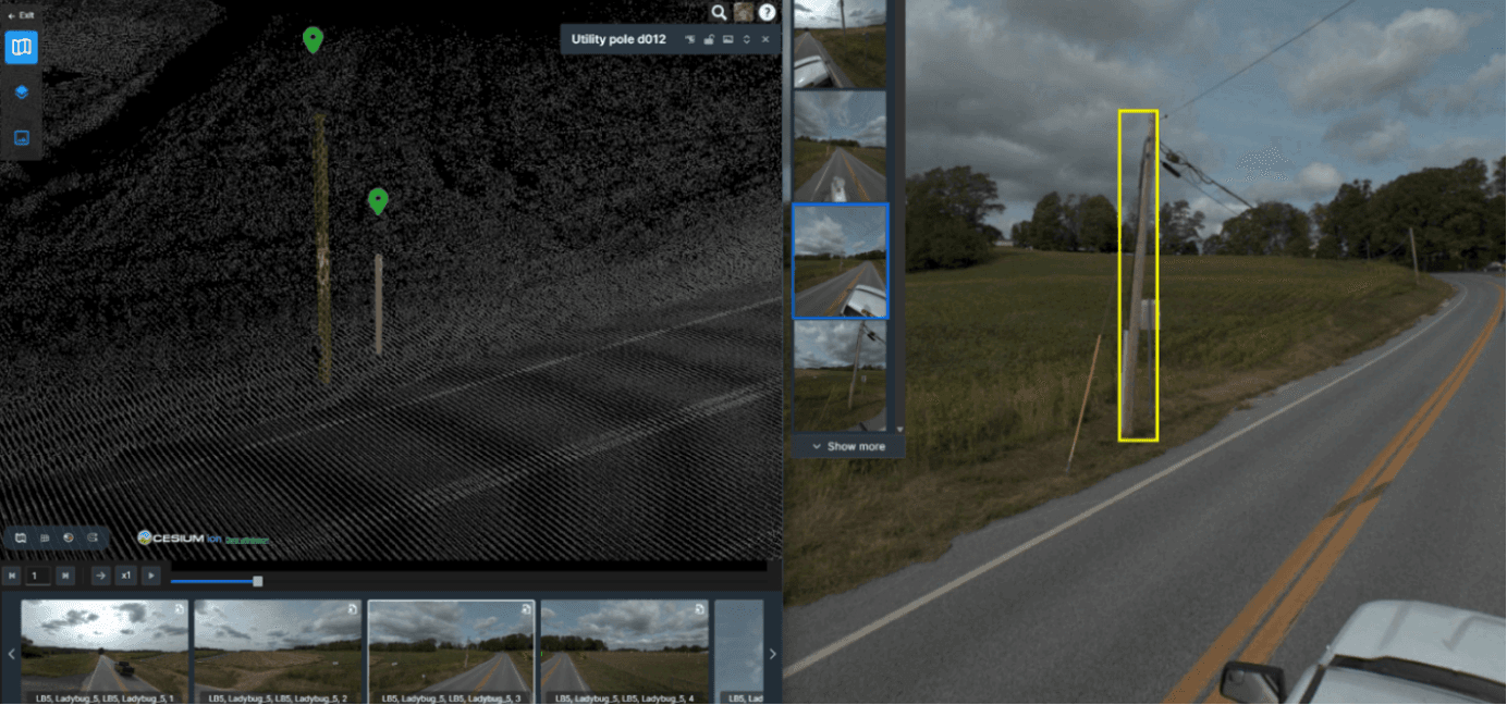
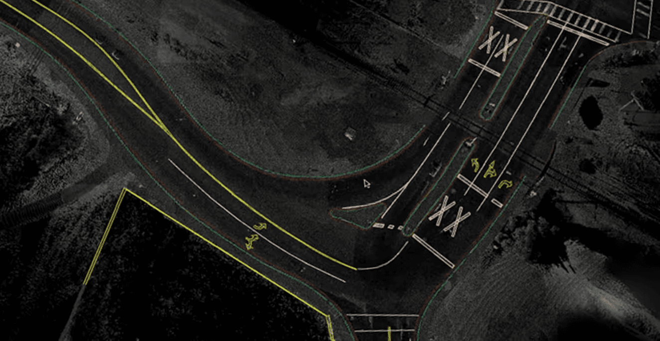
Exports designed to integrate into your existing project workflows.
The outcome.
The flexibility proved critical. When the project’s construction method changed midway, from underground to aerial (which is very common in broadband expansion projects), Fibersmith didn’t need to send anyone back. The data was already there.
- 01Nearly 400 miles covered with 3 days of data collection
- 0215x faster new workflow (mobile mapping + automated feature extraction) compared to the traditional boots on the ground method
- 03Digital Surveyor provided 100% asset visibility in field of view, 97% asset detection accuracy and a seamless QA/QC with reduced manual review
- 04Permitting maps and design-ready data delivered faster than ever before
We backload the decision-making to the office, so the right people make the right calls with the right data. This is the future of how design gets done.
Digital Surveyor works with the data you already collect.





The Carroll County project is now under construction, and Fibersmith is applying lessons learned to upcoming builds. Mach9 has also integrated with Ocius-X, the construction management software Fibersmith uses, making it easier to move from design to build.
Their new “collect first, decide later” workflow has accelerated the planning and design of over 6700 miles of broadband network, spanning across dozens of projects – and this is just the beginning.

Fibersmith specializes in fiber design and partners with broadband providers to close the digital divide in rural and underserved areas. What began as a one-person operation managing inspectors, resident engineers, and funding paperwork has grown into a skilled team of designers, engineers, field inspectors, and consultants. It partners with trusted manufacturers, distributors, and industry leaders to help broadband providers turn their visions into reality. With an operator-focused approach, Fibersmith delivers practical, scalable solutions to meet the unique challenges of every client.

Mach9 builds software that transforms reality capture datasets into high-precision 3D maps, accelerating how teams model and understand the world. Its flagship product, Digital Surveyor, automatically extracts features like utility poles, signs, curbs, striping and more from LiDAR and imagery datasets and turns them into engineering-ready GIS and CAD deliverables. Surveying, engineering, and GIS teams work with Mach9 to reduce the time and cost of 3D mapping and deliver projects faster than ever before.
Founded in 2021 and based in San Francisco, Mach9 is backed by Quiet Capital, Y Combinator, Soma Capital, Tiger Global, and Overmatch Ventures and trusted by leading engineering, construction and infrastructure organizations.
More case studies
See all →
Turning Roadway Assets into Actionable Data for State DOT

Accelerating Rural Broadband Expansion Through Automation and Visibility

Taking a Topographic Survey Start-to-Finish with Mach9 Digital Surveyor
See how Digital Surveyor 2 handles your data.
Send us a sample dataset. We'll extract it and return deliverables free.