Accelerating Rural Broadband Expansion Through Automation and Visibility
Rapid asset extraction replaced months of manual workflows. Make-ready assessments and utility pole audits delivered data for design and permitting within 6 weeks.
Modernizing the workflow at scale.
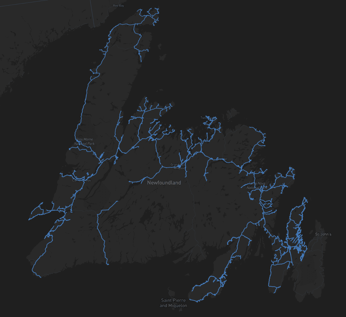
Eagle Engineering and Consulting, a key design and engineering partner in Canada’s rural broadband buildout, was tasked with make-ready fiber assessments and utility pole audits across more than 7,900 kilometers of fiber routes. Partnering with service provider Xplore, they needed to rapidly evaluate joint use readiness, pole conditions, and wire clearances to meet tight deployment timelines. Traditional manual workflows couldn’t tackle these challenges at scale.
With Mach9’s AI-powered Digital Surveyor platform, Eagle Engineering and Consulting quickly extracted pole assets, assessed attachment feasibility, and built a consistent digital record of joint use infrastructure. Work that once took months (using traditional methods, such as human extraction) was completed in weeks, with data instantly available for design and permitting.
What made this hard.

Once we collected the LiDAR, we still had to process, extract, and QA manually, that was where Mach9 came in, to help us maintain accuracy while significantly improving speed.
When Eagle Engineering and Consulting was contracted to support Xplore Communications’ rapid expansion of rural broadband networks in Canada, the stakes were high. Having to map nearly 8,000 kilometers of telecommunications corridors in Newfoundland and Labrador in 3 short months, Eagle Engineering and Consulting needed to rethink its workflows and fast.
Traditionally, utility pole data collection in rural environments relied on field crews capturing just 3 – 5 kilometers per day. Even with mobile LiDAR systems increasing capture to 100+ kilometers per day, the bottleneck had shifted to post-processing and quality control.
How we solved it.
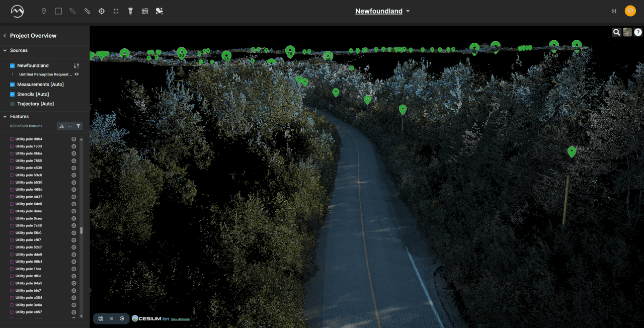
Eagle Engineering and Consulting integrated Mach9’s Digital Surveyor with a clear goal: Automate pole and asset extraction while minimizing manual QA labor.
- 01Confidence in perception results (~95% accuracy)
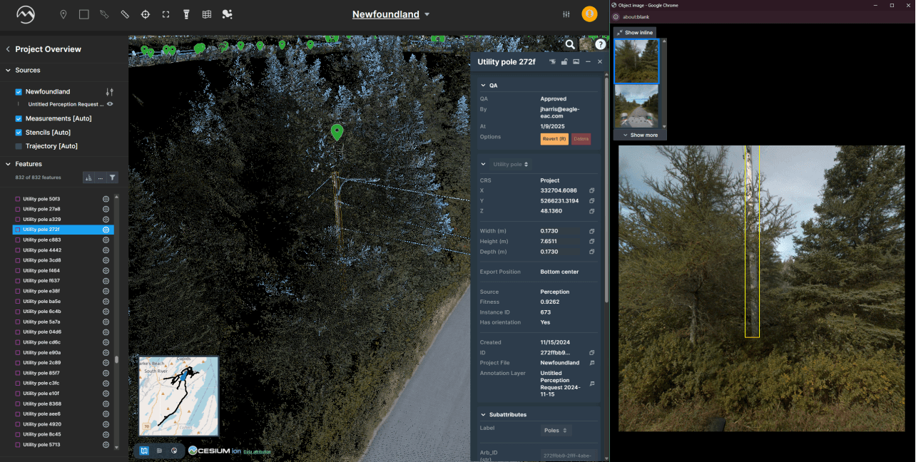
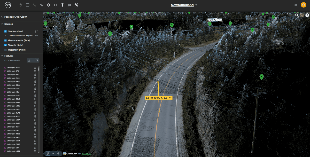
- 02Instant visual QA
- 03Filtered, asset-specific review
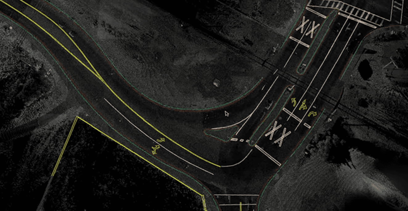
- 04Export-ready data, without manual searching
Instead of beginning from scratch, Mach9 gave us a full network upfront, so we could immediately identify gaps. If there was ambiguity in the data, we could revisit it instantly, review the object, and get a decision in minutes.

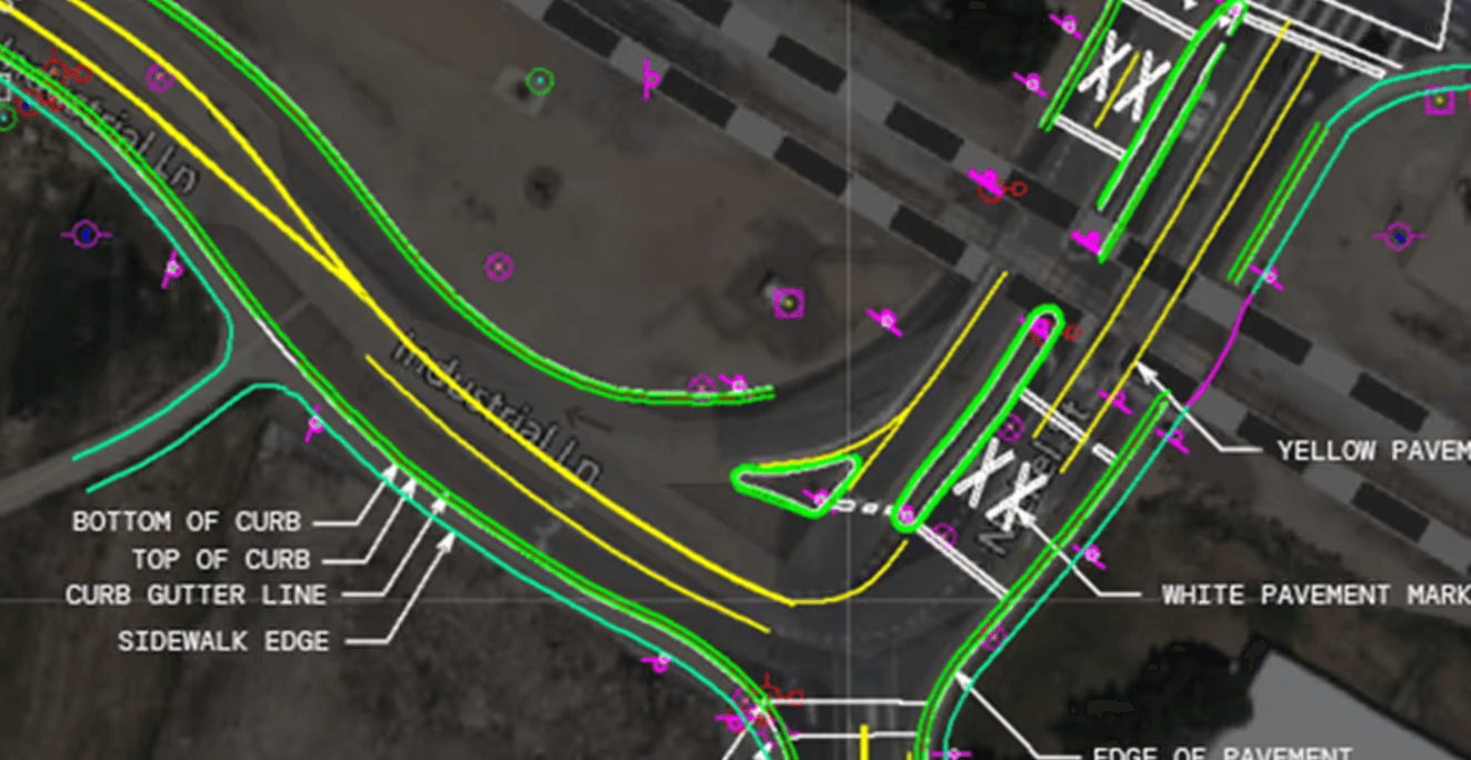
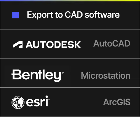
Exports designed to integrate into your existing project workflows.
The outcome.
The new workflow improvements directly impacted client satisfaction and internal operations:
- 017,900 kilometers delivered in 6 weeks (a month ahead of schedule)
- 02Massive reductions in post-processing hours
- 03Digital Surveyor served not only as a QC tool, but also became the viewer of choice for the client, Xplore, counting 80+ users
A Strong Partnership Built on Adaptability
Eagle Engineering and Consulting and Mach9 worked side-by-side to iterate workflows and solve technical challenges. From script-building to interface refinements, the teams co-developed a workflow aligned with Xplore’s needs.
We were both learning each other’s trades. The Mach9 team was patient, receptive, and fast to respond.
Honestly, you were our secret weapon. But not so secret anymore.
Digital Surveyor works with the data you already collect.





Following the success of this broadband deployment, Eagle Engineering and Consulting is actively pursuing a broader integration of Mach9’s AI and automation tools across multiple workflows. This includes joint use permitting, make-ready design, and long-term utility asset management. The firm is also evaluating how Digital Surveyor can support vegetation analysis and digital twin readiness for municipalities.
As broadband initiatives continue expanding into harder-to-reach regions, Eagle Engineering and Consulting aims to set a new standard for geospatial-driven infrastructure delivery with a faster, more transparent, and built for continuous improvement approach.

Eagle Engineering and Consulting is a Canadian firm specializing in geospatial, telecommunications, and infrastructure engineering. Since 1989, Eagle Engineering and Consulting has delivered design, reality capture, GIS, and mobile mapping solutions that enhance visibility, improve safety, and support faster, more informed decision-making. Serving clients in telecom, AEC, and the public sector, Eagle Engineering and Consulting combines technical depth with practical insight to help organizations understand their assets and manage them with greater precision.

Mach9 is a geospatial technology company focused on automating feature extraction from mobile mapping data. Designed for engineering teams, Mach9’s AI-driven tools help convert LiDAR and imagery into accurate, actionable GIS and CAD-ready outputs, improving asset visibility, accelerating project timelines, and enhancing infrastructure management. Mach9 supports clients across transportation, utilities, and public works sectors seeking to scale asset intelligence and automate survey-grade data processing.
More case studies
See all →
Turning Roadway Assets into Actionable Data for State DOT

Data Collection First, Decisions Later: A Smarter Way to Design Broadband

Taking a Topographic Survey Start-to-Finish with Mach9 Digital Surveyor
See how Digital Surveyor 2 handles your data.
Send us a sample dataset. We'll extract it and return deliverables free.